Welcome to FishPAC
The purpose of FishPAC is to collaboratively share science and data related to fish barriers and to prioritize the most important locations for remediation and recovery of species.
Active, Priority & Completed Fish Passage Story Map
Use the map below to review locations.
Purpose of FishPAC
The Fish Passage Advisory Committee (FishPAC) is a joint effort between the California Department of Transportation (Caltrans), California Department of Fish & Wildlife (CDFW), National Marine Fisheries Service (NMFS), U.S. Fish & Wildlife Service (USFWS), and other interested advocates of fish passage efforts.
The FishPACs track the status of active and funded fish passage barriers until they are remediated, to include post-construction fish passage remediation effectiveness. FishPACs nominate and prioritize barriers to fish passage, and support the implementation of meaningful, long-term solutions for funding and barrier remediation within each FishPAC geographic area. FishPACs recommend technical solutions, explore options for accelerated delivery of permits and projects, and identify potential funding opportunities for barrier remediation projects. FishPACs support full-span and stream simulation designs solutions that connect high quality habitat for fish and other aquatic species as well as terrestrial wildlife.
FishPACs advance the remediation of fish passage barriers on the State Highway System, and promote collaborative interjurisdictional solutions, to ensure that barriers are assessed and documented prior to project planning and initiation.
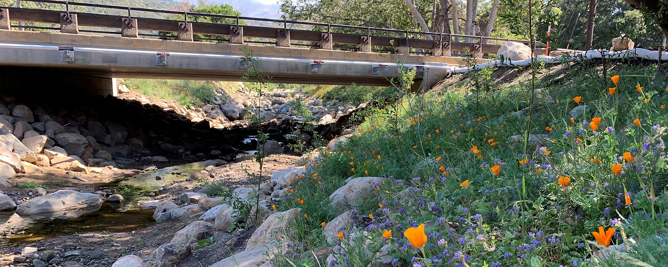
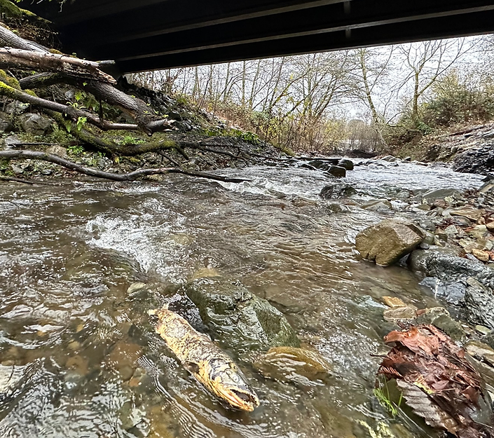
Remediating Barriers
Remediating fish passage barriers is key to enhancing connectivity in California's watersheds. Providing access to upstream habitats will ensure that fish populations can respond and adapt to climate change stressors, such as drought, wildfire, sea level rise, changes in stream flow, and water temperature. The network of over 200 fish passage experts, advocates, and partners throughout the range of salmon and steelhead work collaboratively to address legacy transportation barriers with long-term solutions that facilitate fish passage and climate resilience.
Contributing Partners

![]()
![]()
And other state, local, and federal partners.